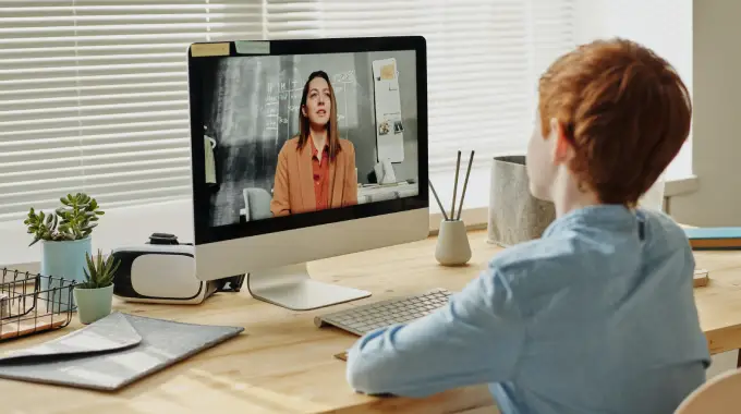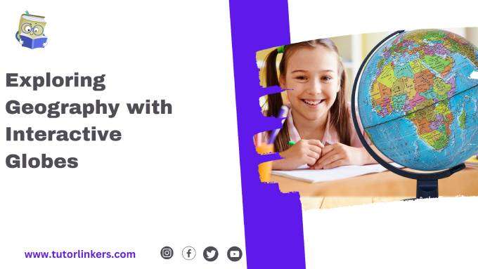
Geography with Interactive Globes: In today’s interconnected world, geography education plays a crucial role in helping us understand the diverse landscapes, cultures, and environments that shape our planet. Traditional maps and textbooks have long been fundamental tools in geography lessons, but now, educators and students are embracing online tutor learning as innovative resources to enhance geographical learning experiences. In this blog post, we’ll delve into the world of interactive globes, exploring their benefits, types, features, applications in geography lessons, and future trends.
Geography education goes beyond memorizing maps; it fosters global awareness and critical thinking. Interactive globes offer a dynamic approach to learning, providing students with immersive experiences that deepen their understanding of the world around them. These tools empower educators to engage students in meaningful ways, sparking curiosity and exploration. By integrating online tutor learning with interactive globes, students can access personalized support, guidance, and additional resources to maximize their geography learning journey.
2. Benefits of Interactive Globes
Interactive globes offer several advantages over traditional learning tools:
- Visual Learning: Students can visualize geographic features, such as mountains, rivers, and continents, in 3D, enhancing comprehension.
- Hands-On Experience: Manipulating interactive globes promotes tactile learning and reinforces spatial awareness.
- Real-Time Data: Accessing live updates on weather, population, and environmental changes fosters relevance and timeliness in lessons.
3. Types of Interactive Globes
There are diverse types of interactive globes tailored to different educational needs:
- Digital Globes: Virtual representations of Earth that allow zooming, rotating, and exploring geographic data.
- Augmented Reality (AR) Globes: Overlays digital information onto physical globes, creating immersive experiences.
- 3D Printed Globes: Customizable globes that facilitate interactive learning through tactile manipulation.
4. Features and Functions
Interactive globes come equipped with various features to enrich geography lessons:
| Features and Functions | Description |
|---|---|
| Zoom and Rotation | Allows users to zoom in and out of the globe to view details of specific regions. The ability to rotate the globe provides different perspectives of geographical features. |
| Geographic Information Systems (GIS) | Integrates layers of geographic data such as climate, population, topography, and more for detailed analysis and exploration. |
| Interactive Quizzes and Games | Engages students with interactive quizzes, challenges, and educational games related to geography topics, enhancing learning and retention. |
| Augmented Reality (AR) Overlay | Overlays digital information onto physical globes, providing immersive experiences and real-world context to geographic concepts. |
| Live Data Updates | Provides real-time updates on weather, population, and environmental changes, fostering relevance and timeliness in geography lessons. |
5. Applications in Geography Lessons
Educators leverage interactive globes for a range of geography topics:
- Continents and Countries: Studying political boundaries, cultural diversity, and economic development.
- Climate and Weather: Analyzing climate patterns, biomes, and environmental impacts.
- Geospatial Analysis: Understanding maps, coordinates, and spatial relationships for navigation and exploration.

6. Enhancing Learning with Interactive Globes
Interactive globes transform geography lessons into dynamic experiences:
| Enhancing Learning with Interactive Globes | Description |
|---|---|
| Visual Engagement | Provides visual representations of geographical features, fostering deeper understanding and spatial awareness. |
| Tactile Learning | Promotes hands-on exploration and manipulation, reinforcing learning through physical interaction with the globe. |
| Real-Time Data Access | Allows students to access live updates on weather, population, and environmental changes, making lessons current and relevant. |
| Immersive Experiences | Offers interactive features such as zooming, rotating, and AR overlays, creating immersive experiences that engage students and spark curiosity. |
| Collaborative Activities | Facilitates group projects, discussions, and virtual field trips using interactive globes, promoting peer learning and collaboration among students. |
| Personalized Learning | Adapts lessons to individual learning styles and interests, catering to diverse student needs and maximizing engagement and retention. |
7. Case Studies and Success Stories
Real-world examples demonstrate the impact of interactive globes in education:
- Schools Integrating Technology: Stories of institutions adopting interactive globes and witnessing student engagement and performance improvements.
- Student Achievements: Testimonials from students who have excelled in geography with the help of interactive globes.
8. Future Trends and Innovations
The future of interactive globes is filled with exciting possibilities:
- Advancements in Technology: Continued development of virtual reality (VR) and artificial intelligence (AI) integration for more immersive experiences.
- Global Collaboration: Potential for interactive globes to connect classrooms worldwide, fostering cultural exchange and collaboration.
9. Best Practices and Implementation Tips
Educators can maximize the benefits of interactive globes with practical strategies:
| Best Practices and Implementation Tips | Description |
|---|---|
| Align with Curriculum Objectives | Ensure interactive globe activities align with curriculum goals and learning outcomes, integrating them seamlessly into geography lessons. |
| Provide Adequate Training | Educate teachers and students on how to effectively use interactive globes, maximizing their potential for engagement and learning. |
| Encourage Exploration and Inquiry | Promote a spirit of exploration and inquiry by encouraging students to ask questions, investigate geographical phenomena, and draw connections using the interactive globe. |
| Foster Collaborative Learning | Facilitate collaborative activities where students work together to solve problems, analyze data, and explore geographic concepts using interactive globes. |
| Integrate with Multimedia Resources | Supplement interactive globe experiences with multimedia resources such as videos, articles, and maps to enrich learning and provide diverse perspectives. |
| Evaluate and Reflect | Encourage students to reflect on their learning experiences with interactive globes and assess their understanding of geographical concepts. |
10. Conclusion
Interactive globes are revolutionizing geography education by offering engaging, interactive, and personalized learning experiences. Embracing these tools empowers students to become global citizens with a deep appreciation for the world’s diversity and complexity.
11. Call to Action
Ready to explore geography in a whole new dimension? Embrace interactive globes as your gateway to a world of discovery and understanding. Whether you’re an educator, student, or lifelong learner, interactive globes can enrich your geography journey and inspire a deeper connection with our planet.
Read More: Study guides for exam preparation
FAQ’s
1. How can interactive globes benefit geography learning?
Answer: Interactive globes offer visual engagement, tactile learning experiences, and real-time data access, enhancing students’ understanding of geographical concepts. They promote active exploration and spatial awareness, making geography lessons more dynamic and engaging.
2. What types of interactive globes are suitable for classroom use?
Answer: Digital globes, augmented reality (AR) globes, and 3D printed globes are all suitable for classroom use. The choice depends on the specific educational objectives, age group of students, and available resources.
3. How can educators effectively integrate interactive globes into geography lessons?
Answer: Educators can integrate interactive globes by aligning activities with curriculum objectives, providing adequate training to teachers and students, fostering collaborative learning experiences, and supplementing lessons with multimedia resources. Evaluation and reflection on learning outcomes are also essential for effective integration.
Author
Ehsan Ali is a seasoned content writer and researcher with a talent for translating complex concepts into clear, engaging content. With a deep understanding of human behavior, societal trends, and technical topics, Ehsan creates insightful and impactful content that resonates with a broad audience. His expertise ensures that each piece is both accessible and compelling, bridging the gap between intricate details and everyday understanding.